ADDRESSING: Leave a car in Máguez and another at the entrance of Guinate (a few hundred meters to the left). DISTANCE: 4 miles. DIFFICULTY: Low. DURATION: Two hours, two hours. PLEASE NOTE: Wear appropriate clothing and shoes. Water. Some chocolate and pastries. Hat and sunscreen. Do not forget the phone.
As usual the north of Lanzarote, this is a path full of striking contrasts. About 100 meters from the entrance to Guinate, left, find a comfortable path upward about five feet wide. Our back the garrison of the Corona Volcano, omnipresent throughout the day along with other volcanic cones with different features and colors. There is a thick blanket of silence that accompanies the cold clouds and brings the dawn. The elevation is abordabl and with minimum fitness and the conditions of sufficient security for the eyes flit around us.

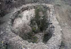
In various sections stumble with gorse, cruets, veroles, tabaibas, traditional crops such as figs and grapes. In this rugged area also emerge as the Toji wildflowers, lavender, lamb’s tail and poppy. Intermittently, our attention little nooks built with natural stone to rest livestock themselves (see photo at right) scattered in the triangle of Guinate, Gallo and Máguez. The rich biodiversity is complemented given the presence of birds such as falcons, quail and doves.

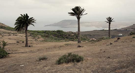
However, postal traffic landscape from this spot the stars of the day. A fifteen minute walk, we stumble across a beautiful image of the island of La Graciosa and Montaña Clara’s profile on the horizon (Chinijo Archipelago, northwest of Lanzarote). The Guinate ravine, with the town at its mouth, dotted with vines and palm trees and whimsical birth Veroles pink flowers make up the rest of the picture.
As the Corona Volcano behind us, the islands of Archipelago Chinijo are a constant in the path. As we move to the southeast, and Máguez Gallo, perceive other very curious Yellow Mountain profiles of La Graciosa, Montaña Clara and Alegranza islet, which share the immense display of Famara cliff. These jewels Atlantic invite to leave the safe path and approach the edge of this cliff. It is just as safe if we take the necessary precautions and the respect they deserve by now and the strong prevailing wind.

When route, find the sources of Gallo. Waterworks populations Haria, Máguez and mediocrity until the beginning of the desalination and purification in Lanzarote. Today, daisies grow within it, while maintaining its natural stone structure (see photo at right). Towards the coast, continuing progress towards the south, the nautical view postal increases with Famara beach to the south and north islands Chinijo.

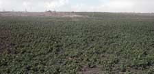
Beyond this space, easily identify the continuation of the path leaving the coast to the right. An airport utility infrastructure is apparent given access to a stretch of road that will lead to Máguez. The road, four to five meters wide, it gets down in a horseshoe shape. Now, with the Corona Volcano in front, the landscape is transformed into a vast wilderness area of various crops in sanded and terraces. Heavy tonali dark ties mountains contrast with the green color splashed the ravine toward the northern town of plantations browns that dominate the area. Again, the rich landscape surprises us when we scrutinize the slender figures Máguez and would make, although geographically separated, seem to have a special tune.
