Mancha Blanca – Caldera Blanca
Text: Leisure Lanzarote. Photography: Dani Stein.
WHERE TO START: Park your car at the exit of the town of Mancha Blanca towards Timanfaya. DIFFICULTY: Medium. DURATION: Approximately two and a half hours. WHAT TO BRING: Wear appropriate clothing and shoes. Bring water, some chocolate or snacks, a hat and sun screen. Do not forget your cell phone.
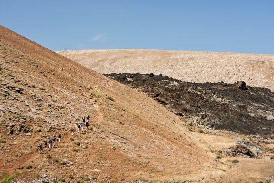
At a crossroads, on the Mancha Blanca-Timanfaya road, you will easily spot the beginning of the trail. It is a very wide dirt path, about thirteen feet [four meters] wide, from which you can clearly see the end of the trail: Caldera Blanca. Around the trail, strips of volcanic lava dominate the scenery. This will be the leitmotiv of today’s hike, constantly changing and keeping us engaged as we observe, all along the trail, how solidified lava takes the most abstract and varied forms.

Ten minutes into the hike we will come across a sign informing us that, no doubt, we are in a nature reserve. This is Timanfaya. To be exact, we are in the area where the last eruptions took place in the 18th century. According to the legend, this is where the Virgin of Los Dolores of Tinajo stopped the melting of the volcanic lava. At this point, the trail becomes narrower and the dirt is replaced by hard, rough volcanic rocks. This is why it is advisable to wear hiking boots. The scenery is extraordinarily beautiful. You’ll spot green lichen growing on rocks, fig trees, bobo trees and gorse bushes. They all contribute to giving this volcanic scenery a mysterious aura: a silent earth of fire.

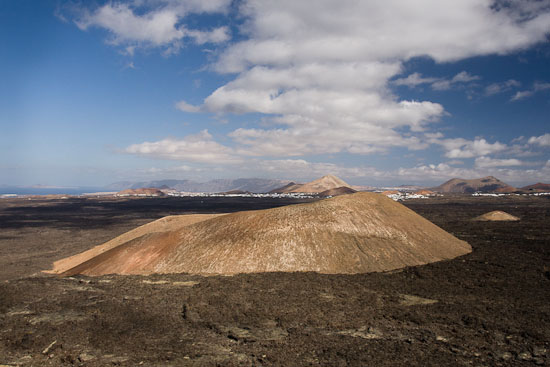
After walking for 45 minutes you will tackle the path that leads to one of the mountain peaks of our hike. It’s called Montaña Caldereta. Through an immense opening you will approach the wide crater. Perfect timing! Time to take a break and contemplate the beautiful scenery, taking cover in small natural stone shelters carved by the local goatherds.

The trail continues in search of the access to Caldera Blanca. Through the mountains you will cross one of the most impressive parts of the trail. The beautiful shapes of lava that have been sculpted by erosion look like gigantic chunks of olivine, thanks to the luscious vegetation that grows on them. After hiking for about an hour you approach a smooth uphill stretch which will lead you to Caldera Blanca. Just before reaching the top it’s worth taking a moment to look towards the north of the island. You will be able to appreciate several kilometers completely covered with lava and you can see the how this treacherous soil interrupted the conquest of the island on the side of what is now called Mancha Blanca. On a clear day you can easily spot the Famara cliff (risco de Famara), the island of La Graciosa and Montaña Clara. A mix of postcards of breathtaking beauty.

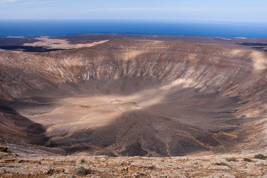
We finally reach the top of Caldera Blanca. We couldn’t have imagined how majestic it is. What an amazing crater! With its various shades of color: white, ochre, reddish, and green; the abundance of gorse bushes that spot its slopes; the incessant wind; the powerful silence; the diversity in scenery… Its ring invites us to walk around and capture different moments, different visions. “This is the best hike I’ve taken in Lanzarote” says our walking companion for the day without hesitation, and this is coming from someone who has already walked most of the geography of the island. “The best, the best, isn’t it?” he insists, to which we say: “You know, it might be”.
Note: Leisure Lanzarote grateful for the photographic work of Daniel Stein illustrating this post informative. His photos.
For before and after: There are a few options to recover our strength after the hike: a few miles from Mancha Blanca is Monumento al Campesino, Las Cadenas restaurant in La Vegueta or Caserío de Mozaga If you enjoyed the beautiful scenery of the nature reserve of Los Volcanes, there is another spot with a great panoramic view: El Chupadero of La Geria.
