Ortiz-Tinguaton

Ortiz-Tinguaton

Text: Leisure Lanzarote. Photography: Dani Stein.

ADDRESSING: Leave the car at the outskirts of Tinguatón Place in a car park at the foot of the Natural Park of the Volcanoes. DISTANCE: 11.5 miles. DIFFICULTY: Low. DURATION: Approximately four hours. PLEASE NOTE: Wear appropriate clothing and shoes. Water. Some chocolate and pastries. Hat and sunscreen.

A spectacular tour in the Natural Park of the Volcanoes. Locate the beginning of a very simple path. A one kilometer south of Tinguatón stumble out of a fairly large parking area. On the left side of the road, just across the parking lot, find a wooden placard reveals the itinerary. Also, is evident across the road, framed by a loose dusty dirt road amid the majestic form lava as this protected area.
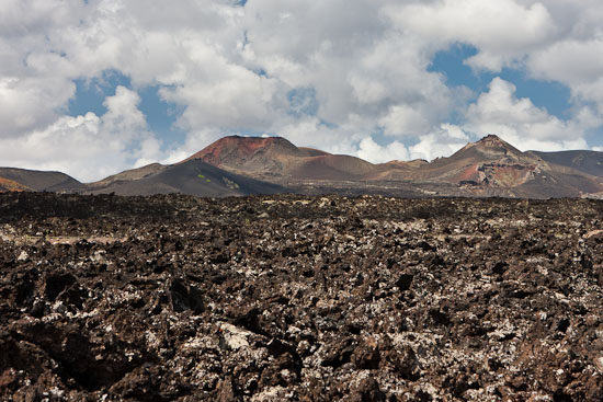
The magma solidified over the centuries is the most unique picture of the path. The stage, dry appearance, in contrast to the paradoxical presence of multiple full wash plant. The most peculiar, of course, comes from shellfish and moss embedded in the terrain. However, catches the eye the appearance of verodes, figs and palms rofe splashing the surrounding lava.
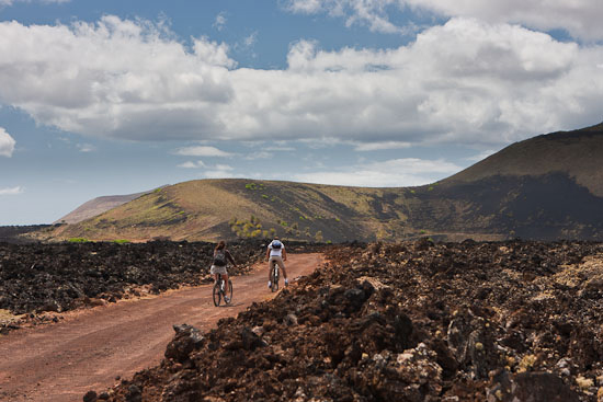
A deafening silence surrounds this whole area, where we shelter and Ortiz Mountains Tinguatón. The capricious ways of the vast surroundings make sit and watch the beautiful postcard of the nearby mountains of Timanfaya. The black ash and dark forms of lava that bathe this scenario fit perfectly with red ocher and prevailing in the neighboring peaks of fire. In just one hour of kick in the south and south-southeast, have seen different perspective s priceless landscape.

At the height of mountain Ortiz, continue southwest to southeast with the aim of achieving Tisalaya in about an hour. A half hour drive will find a hidden form of picnic space. A strange sign welcomes us to a charming cave, used to celebrations. The sign displayed the various applications in the calendar that have given life to the little nook Underground: birthdays and partying basically. Without doubt, a different conclusion and surrounded by lava and night penetrating this location. After two hours of trail, picnic area is ideal for a power supplies.
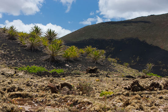
From this point contemplate the continuation of the road. A small slope, easily detected by the appearance of three hardwood tree species too, puts us in a new stage. With a higher level of erosion, the layer of lava appears to us utterly devastating. Our retina includes ash bath that fills the horizon: a snapshot of an exquisite beauty. In the distance, at the height of Tisalaya, you begin to see the hand of man with the unique work archite chthonic sheltering island agriculture.
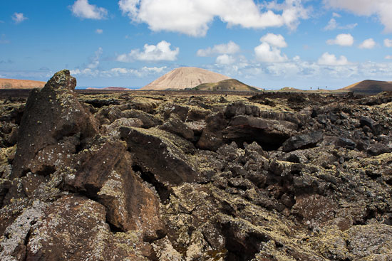
This is an example of human ingenuity. The use of any settlement become wet crop. The prevailing trade winds are fighting, and combat, with the ASOC’s area through the provision of natural stone. Among Tisalaya and the neighboring town of La Vegueta, there are infinite spaces grown from solidified magma and surrounding mountains. In this sense, the resulting landscape although messy, among many grape vines, crops of potatoes and onions is intoxicating.
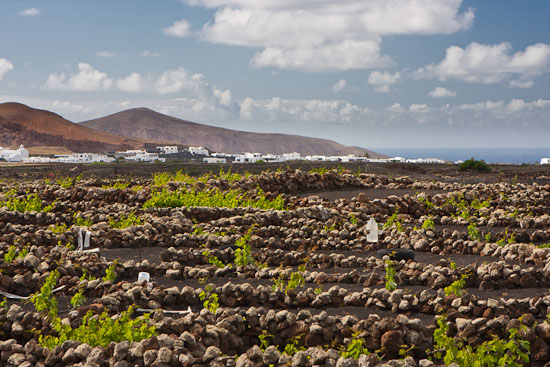
This part of the trail loses some of its elegance. No urban order, although the houses amidst natural surroundings fit with the environment. Many of these homes built its own warehouses. The creation of homemade wine has spread throughout the municipality Tinajo. Thus, the proliferation of vine crops is the dominant tone of this strip of land. We are located between the Vegueta and Mancha Blanca. The various samples of traditional architecture of Lanzarote up or No appeal of this place. In the vicinity of White Spot, at the height of the Hermitage de los Dolores, return to Tinguatón started four hours after the kick.

Note: Leisure Lanzarote grateful for the photographic work of Daniel Stein illustrating this post informative. His photos.


Ver Ortiz-Tinguatón en un mapa más grande

You might also like

Explore similar topics

Ortiz-Tinguatón

Texto: Ocio Lanzarote. Fotografía: Dani Stein.

CÓMO ABORDARLO: Dejar el vehículo en las afueras de Lugar de Tinguatón, en un aparcamiento al pie del parque natural de Los Volcanes. DISTANCIA: 11.5 kilómetros. DIFICULTAD: Baja. DURACIÓN: Alrededor de cuatro horas. A TENER EN CUENTA: Llevar ropa y calzado adecuado. Agua. Alguna chocolatina y bollería. Gorra y crema solar.

Un recorrido espectacular en pleno parque natural de Los Volcanes. Localizamos el inicio del sendero de forma muy sencilla. A un kilómetro aproximado al sur de la salida de Tinguatón tropezaremos con una zona de aparcamiento bastante amplia. En el margen izquierdo de la carretera, justo enfrente del estacionamiento, hallaremos un cartelón de madera que desvela el itinerario. Asimismo, se aprecia nítidamente toda la ruta, encuadrada en una holgada vereda de tierra en medio de las majestuosas formas de lava de este espacio protegido.

El magma solidificado con el paso de los siglos resulta la estampa más singular del sendero. El escenario, de apariencia seca, contrasta con la presencia paradójica en plena lava de múltiples especies vegetales. La más peculiar, sin duda, procede del molusco y el líquen incrustados en su orografía. Sin embargo, llama poderosamente la atención la aparición de verodes, higueras y palmeras que salpica el rofe circundante de la lava.

Un atronador silencio envuelve todo este territorio, donde nos cobijan las montañas de Ortiz y Tinguatón. Las caprichosas formas del vasto paraje invitan a sentarnos y contemplar la bellísima postal de las cercanas montañas de Timanfaya. La negra ceniza y las oscuras formas de lava que bañan este escenario encajan perfectamente con el ocre y el rojizo imperantes en las vecinas cimas de fuego. En apenas una hora de pateo en dirección sur y suroeste-sureste, hemos asistido a diferentes perspectivas de incalculable valor paisajístico.

Terrenos agrícolas en medio de la lava

A la altura de montaña Ortiz, seguiremos en dirección suroeste-sureste con el objetivo de alcanzar Tisalaya en una hora aproximada. A la media hora de camino encontraremos un recóndito espacio en forma de merendero. Un curioso cartel nos da la bienvenida a una coqueta cueva, que sirve para celebraciones varias. En el letrero aparecen las distintas solicitudes en el calendario que han dado vida al pequeño recoveco subterráneo: cumpleaños y parrandas básicamente. Sin duda, una celebración diferente rodeados de lava y la penetrante noche de este parque natural. Tras dos horas de sendero, el merendero resulta lugar ideal para tomar un buen avituallamiento.

Desde este punto contemplamos la continuación del camino. Una pequeña ladera, fácilmente detectable por la aparición de tres especies de árbol muy frondosas, nos sitúa en un nuevo escenario. Con un mayor nivel de erosión, el manto de lava se nos presenta completamente devastador. Nuestra retina contempla el baño de ceniza que puebla el horizonte: una instantánea de una primorosa belleza. En la lejanía, a la altura de Tisalaya, se empieza a apreciar la mano del hombre con la singular obra arquitectónica que cobija la agricultura insular.

Se trata de una muestra de ingenio humano. El aprovechamiento de cualquier asentamiento húmedo transformado en cultivo. El alisio imperante se combatía, y se combate, con el asocamiento del terreno gracias a la disposición de piedra natural. Entre Tisalaya y el vecino pueblo de La Vegueta, hay infinitos espacios cultivados entre el magma solidificado y las montañas que lo rodean. En este sentido, el paisaje resultante aunque desordenado, entre tantas parras de uva, cultivos de papas y cebollas, es embriagador.

Esta parte del sendero pierde algo de elegancia. No hay orden urbanístico, aunque las casas en pleno paraje natural encajan con el medio. Muchos de estos hogares incorporan sus propias bodegas. La creación del vino casero se ha extendido por todo el municipio de Tinajo. Así, la proliferación de cosechas de vid constituye la tónica predominante de esta franja de territorio. Estamos situados entre La Vegueta y Mancha Blanca. Las muestras diversas de arquitectura tradicional lanzaroteña conforman un atractivo de este paraje. En las cercanías de Mancha Blanca, a la altura de la Ermita de Los Dolores, retornaremos a Tinguatón cuatro horas después de iniciado el pateo.

Nota: Ocio Lanzarote agradece el trabajo fotográfico de Dani Stein que ilustra esta entrada informativa. Sus fotos.

Para después del pateo: Podemos degustar unas tapas canarias en El Monumento al Campesino.


Ver Ortiz-Tinguatón en un mapa más grande

You might also like

Explore similar topics

Similar Articles:

Femés-Papagayo

To the heart of the Natural Monument of Los Ajaches. This is a path that will allow us to cross one of the natural attractions of southern Lanzarote. Can not be compared with its neighbors and the Timanfaya Geria, but the route, visually monotonous in almost all the way, trapped by his strange charm. Although not difficult nor extremely hard the road, no recommendations addressed to children under 14 years.

Teguise – Famara

At times we will only have eyes for the <strong>immense Famara cliff</strong>. But our eyes, inevitably get caught by the beauty of the islands of <strong>La Graciosa</strong>, <strong>Alegranza</strong> and <strong>Montaña Clara</strong>. Back on Lanzarote, the <strong>extension of the natural volcanic sand called <em>jable</em></strong> seems endless from above and it gets less dry and yellowish as our gaze moves towards Mozaga.

Haría – El Bosquecillo

The valley of the thousand palm trees of Haría is one of the most spectacular pieces of the varied landscape of Lanzarote.

Femés-Playa Quemada

In the direction of Playa Quemada, one of the most spectacular beach on the island. From the first moment we perceive the immense valley of Femés to cross during the day. In general, the paths to walk are tight, corresponding to very traditional herds of goats in the area. Accordingly, in a first stage, we must walk carefully along the banks of the trail and very zigzaceantes soil slopes, uneven and poor care.