Caleta del Sebo-Montaña Amarilla
ADDRESSING: Departure by boat from Órzola (north of Lanzarote) to Caleta del Sebo (La Graciosa). On foot or by bike (the bike we can take from Lanzarote or rent it for about ten euros in La Graciosa). DISTANCE: 12 miles. DIFFICULTY: Low-Medium. DURATION: Between three and a half and four (on foot) and two and two and half hours (by bike). PLEASE NOTE: Wear appropriate clothing and shoes. Water. Some chocolate and pastries. Hat and sunscreen. Do not forget the phone. It is recommended points some cell r taxi service Caleta del Sebo.
La Graciosa is a natural place of beauty and peculiar charm. Transit through the strip south of the island is a quiet ride. It involves the contemplation of many landscapes, where the sea and earth come together offering capricious and varied forms. When you reach Caleta del Sebo we decide to make the journey on foot or by bicycle. Both are good choices, but we can tackle the route on foot along the coast. If we went for a bike, it must be remembered in many areas of accumulation loading walk jable go with it. From the capital Gracioseros, depart westbound to Yellow Mountain, southwest of the island marked on the horizon as a target. On leaving the village we find the camp of the bay of El Salado.
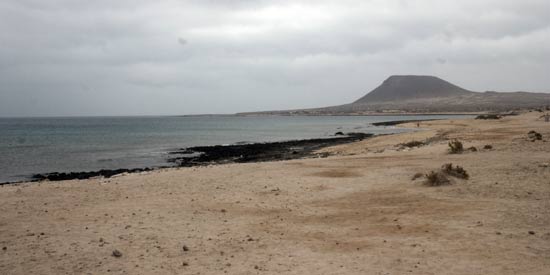
To the south, the imposing cliffs of Famara in Lanzarote faithfully accompanies our steps. Just the wind, causing a deafening silence, broken only rarely by seagulls and the Cory’s shearwaters flying over the nearby tide.
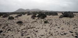
Twenty minutes of kicking, we stumbled on the beach of El Salado. Despite the dry conditions, the coast is subjected by abundant plant populations that cross, seem organized, from south to north island. The water is clear and quiet waiting to break their parsimonious state. It is tempting, but I recommend waiting for a more advanced way (Yellow Mountain, Beach Kitchen).
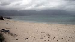
Much like the previous one, arises from the beach absolutely nothing from the French. A little over a wider and longer than Salado. More ASOC and peaceful thanks to the proximity of Yellow Mountain. We skirt the coast on arrival of this enigmatic rock or crossing a road clearly visible at the end of this beach. Some, in these early hours, have already prepared what will be a long day of peace. There they stand, in the recesses of natural stone that populate the beaches of La Graciosa.
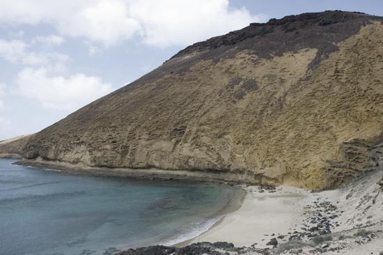
Once this small dimension, witness the explosion of colors of Yellow Mountain. Its base color is mustard (hence its name), but his showmanship comes from combining with its petite maroon top. The traveler who visits La Graciosa, at no time imagine the existence of the cove suggestive linking land and sea. This is the beach of La Cocina. The picture below speaks for itself. We invite you, after an hour and a half route, test your leisure waters. Is a bathroom glory know. Good times this, while we dry mustard on the plates of the mountain wondering how nature creates these spaces, to regain strength.
The trail continued climbing addresses the gap between the beach and Yellow Mountain. The go round in a very narrow path, typical of a step of goats. From this point we get a magnificent view of the way done: Punta Fariones the Famara cliff, the river that joins Lanzarote and La Graciosa, Caleta del Sebo and the beaches of El Salado and the French. The passage from south to north of the island is clearly seen by the wind. Stick with enough intensity and it shows on t period, if we go by bike. Listen for ciclosenderistas because the little way of goats, already complex film is interrupted in some segments of the shifting of the winter rains.
From Yellow Mountain hike northwest to northeast. Reach the nose of La Carrera, north of La Graciosa. This area looks like a natural set western . The vegetation, especially gorse, flooding the landscape. Conquered the hill, patearemos west-east, a few meters from the north coast of the island. As is opening day, the mystics perceive clearly neighboring islands La Graciosa, Montaña Clara, so close and so far the Roque del Oeste and a little more sheltered by clouds, Alegranza.
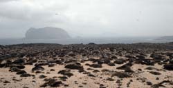
We carry three hours of road. Face the latter. Very simple. On the way west to east elevation contemplate another mountain, the mountain of Cairn. Go round by the north face north-south direction. Just a mile detour will be on one of the main streets of La Graciosa. We will see some plantations. Cairn’s walk from north to south, back to the capital, Caleta del Sebo. It’s another opportunity, quietly, attending to the path traveled in its entirety. D and back, we can finish the four-hour kick sustenance at a restaurant or taking a well deserved beers at the busy summer terrace of La Graciosa. Recommending, any piece of fresh fish.
