Tiagua-Caleta de Famara
ADDRESSING: Leave a vehicle in the church of Tiagua and another on the beach we choose to take a dip in Caleta de Famara. DISTANCE: 14 miles. DIFFICULTY: Low. DURATION: Between three and a half to four hours. PLEASE NOTE: Wear appropriate clothing and shoes. Water. Some chocolate and pastries. Hat and sunscreen. AFTER THE PATE: Bathing at the beach of San Juan or the kilometric good fish lunch or Famara Caleta de Famara.
The first step between the church and the Museum Courtyard of Tiagua do not suspect the nearby burst into one of the most unique landscapes of Lanzarote. Looking desert, the road to Soo and Caleta de Famara (northwest and northeast the first season the second) puts us squarely in the path of jable of marine origin, which has occupied much of the surface of the island. This trip through Lanzarote Jable part from the Atlantic, north of the island, and atravie sa central strip created by the crowded beaches of Playa Honda Puerto del Carmen, the southeast of the island.
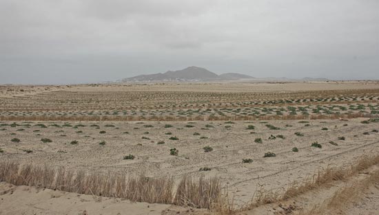
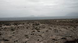
A few hundred meters from the entrance to the Museum El Patio, clearly identifiable find a detour that will guide us throughout the journey. From the start, we consider the peculiar situation with the postal desert Famara cliff as lighthouse the journey and the vision of Chinijo Archipelago (islands north of Lanzarote) constant companion. That is why many times the route may seem a bit monotonous.
Immersed in the jable with Tiagua behind us, we find many that dot the dry crop acres. What will these seedlings of yellow flower? Pumpkins. Beautiful pumpkins. Although it may seem paradoxical, the dry stage was ground cereal crops, wheat and rye, orchard planting tomatoes, melons, watermelons, sweet potatoes and pumpkins already mentioned.
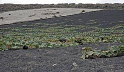
These, along with sweet potatoes, they are presently very low production. Stumbled upon an old farmer and confirms that in effect: “From here (Tiagua) Soo, sweet potatoes, watermelons, melons … today, young people have their jobs and keep the batatita few.” The former economic powerhouse of the island with fishing, farming today is weekend: “The field is aperriao “, Says the friend. A brief but complete description of the methods of cultivation in this area and the sacrificial mechanism, find it in this super text Marta Peña Hernández.
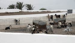
The trail is easy. Fairly wide with a soft but firm on jable gradually be felt in our lower body. There are many roads that intersect. Non tiing, the best will be walking west-northeast to find the perpendicular from the village of Soo, clearly visible from the exit of Tiagua. Once at that point, change the direction from east to northwest to find a pen of goats that will welcome in this peaceful Rincon ng Lanzarote.
Along the way we will have left the sweet potatoes and pumpkins, a motocross funny and horrifying trail of the extraction of gravel for construction. The eternal gorse, characteristic of drier environments of the island, we also have company, as well as from the sky accompanied our steps some species of birds like Houbara bustards and plovers. The silence is deep, typical of the picturesque place, nailed to any natural setting of a Western by John Wa yne.
In Soo we gaining momentum in the benches of the main square or bar Entry . We covered the first part of the trail, six miles. We’ve got another eight, which separated from Caleta de Famara Soo. In west-east direction of Soo will leave the left side of the road. Colorado Assn of the peak and the boiler Back of this village, about 500 meters you will find the path that will put us back in full jable path. Back boiler skirt and Juan Iron Mountain to the north.
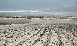
From this point, depending on the day that yes, we can witness in all its splendor the islands of Montaña Clara, Roque del Oeste and La Graciosa where the latter stands Yellow Mountain. Continue north until overcome by another small north face coat, mountain girl, which vary the route to go to the village of Famara.
As we approach this core, the majestic cliffs of the beach combined with the picture of the islands of Chinijo explain this route we are about to end. From the north side of the Atlantic Ocean bathes Lanzarote, goes to Swiss punctuality at all hours every day that we have called marine sand jable. From here irrigates the entire central belt of the island and bays populated southeastern sea such as Playa Honda Puerto del Carmen.
A few miles west of Famara beach camp appears San Juan. Right in the July season that was covered this way, the campers plague this haven of peace and tranquility. Surprised by the great organization of each season camper. Seem authentic homes, second homes, well, television antennas including two meters of water and magnificent views.
In Famara, after three hours of kicking about, we walked on jable. It is the only village of the island that has maintained its road system in this state. There is movement in Caleta, not surprisingly, is one of the most visited for its spectacular and long beach sheltered by his equally impressive cliff.
